


Recent Stories
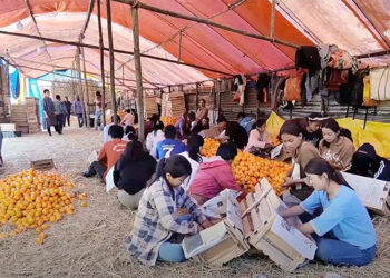
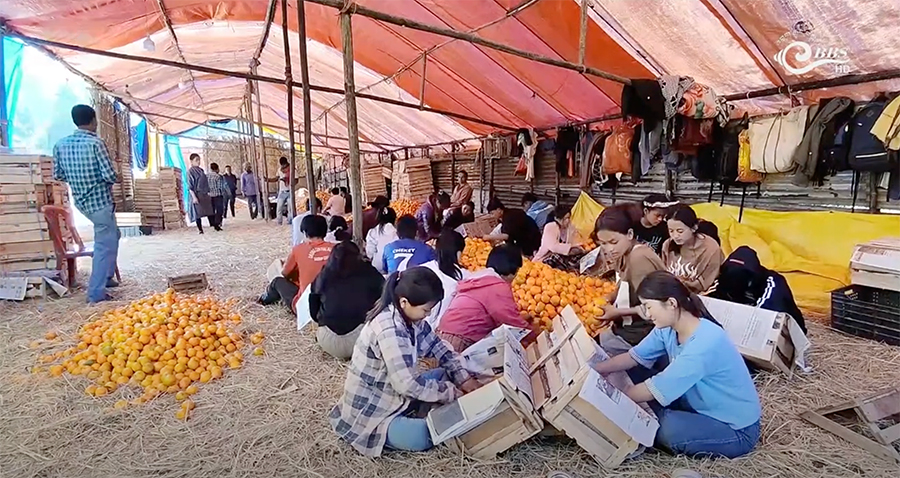
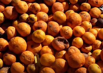
Winter jobs at orange depots help Samdrup Jongkhar students ease financial strain
Winter offers students the perfect opportunity to spend quality time with friends and family, creating lasting memories during the season....
Phuentsholing’s Happiness Centre battles funding shortage amid rising demand
Phuentsholing’s Happiness Centre is struggling to keep up with the growing demand for its services. Since its establishment in 2019,...
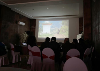
Government plans to expand orange export markets, eyeing Thailand
The country’s orange exporters are seeking to diversify their markets beyond Bangladesh and India, seeking better prices for their produce....

New rules for occupying government housing
People occupying government housing in Thimphu must now adhere to a new set of conditions if they want to continue...

MoIT to set up Mobile Monitoring Unit to ensure quality construction
To address the public construction quality issues, the Infrastructure and Transport Ministry plans to set up a separate mobile monitoring...
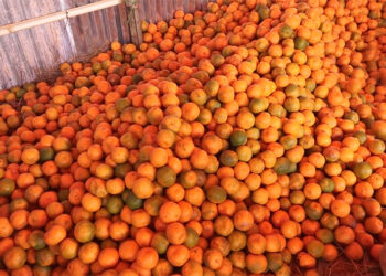
Citrus fruit drop threatens orange yield, farmers unite to combat infestation
Orange, a cash crop in Maenchhuna village in Dagana’s Drujeygang Gewog, have been hit hard by the Chinese citrus fly,...

Audit observes poor workmanship in farm road GSB projects
In its latest report, the Royal Audit Authority revealed several audit issues concerning the laying of Granular Sub-Base (GSB) on...
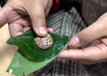
Areca nut use hits 60% in Bhutan, raising health concerns
The National Health Survey 2023 reveals that areca nut consumption among Bhutanese aged 15 to 69 rose to nearly 60...


Politics

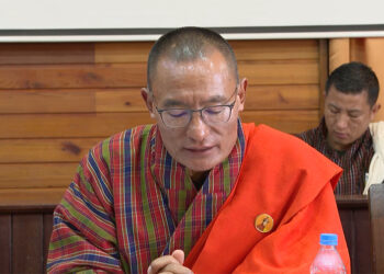
RCSC defends PME category, proposes targeted support for civil servants
The Royal Civil Service Commission (RCSC) indicated that it is exploring alternative support measures for civil servants classified under the...


Recent News
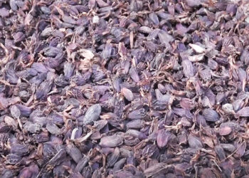
Farmers benefit from rising cardamom prices in Khangma Chiwog, Pema Gatshel
A decade ago, the people of Khangma Chiwog in Pema Gatshel’s Yurung Gewog began growing cardamom to boost their income and improve their livelihood. While the crop helped them make money, it didn’t meet their expectations. However, cardamom prices have doubled this year, bringing farmers significant financial relief. The residents of Khangma Chiwog began cultivating cardamom about ten years ago...

Two sub-posts in Pema Gatshel remain closed without Health Assistants
In Pema Gatshel, community sub-posts in remote chiwogs seem to be bearing the brunt of the ongoing health staff shortages in the country. Sub-posts in two chiwogs in the district have remained closed for months due to a shortage of health assistants. Sub-posts in the villages are usually manned by a lone health assistant providing basic health services. The issue...
Government working to secure funds to implement Third Child Cash Incentive Programme
The government is working to secure funds to implement the Third Child Cash Incentive Programme. The initiative intends to provide Nu 10,000 per month to women for their third and subsequent children until the child attains three years. Prime Minister Tshering Tobgay said this during the Meet the Press session today. It is to encourage Bhutanese families to have more...

Lingzhi Dzong inaugurated after extensive renovation
The Lingzhi Dzong, a historically significant fortress in north Thimphu, was officially inaugurated today. Indian Ambassador to Bhutan, Sudhakar Dalela, inaugurated the dzong following its extensive renovation in October. Restoration work, part of the Lingzhi Dzong Conservation Project, began in 2018 after the Dzong was severely damaged in the September 2011 earthquake. The dzong was renovated with the funding support...
Bhutan Broadcasting Service (BBS) is Bhutan’s primary national broadcaster, delivering diverse news and entertainment in multiple languages, fostering cultural understanding and public knowledge.